 |
 |
 |
 |
 |
 |
 |

Reports of members activities for 2021 are below.
Members activities for 2022
Members activities for 2023
Roman footsteps; a walk along Hadrian’s Wall - Report by Judy Renshaw
This year, with foreign travel remaining uncertain, I took the opportunity to explore some areas of the UK I had not visited before. One of these was the recently developed (2003) path along the route of Hadrian’s Wall from the Solway Firth to the Tyne estuary. I chose to join a group, both for company and to avoid having to arrange my own accommodation and food along the way. The group members provided additional knowledge and insights about the history of the wall and were also fun to be with.
The wall was built over a period of 6 years around the year 122AD, when Hadrian himself came to inspect it. The Western part was built of sandstone and the Eastern part of limestone, based on their local availability. Trained Roman legions were involved in its construction, and afterwards it was manned by auxiliaries, some of whom came from other European countries. There were mile-castles at each mile and two turrets between each of these, many of which can still be seen. A wide ditch, or vallum, ran along either side, except where natural features, such as crags, made this unnecessary. Most of it remained in use for around 300 years.
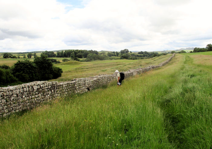
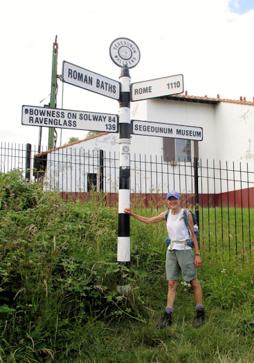
It took us 6 days to walk the full length, covering about 92 miles. Although the official path is only 84 miles, we added some distance at the beginning and made a few detours for sightseeing. We stayed in 4 different locations, sometimes walking straight to and from the accommodation and sometimes having a coach to take us to and from the start and finish points of each day. I took a train to Carlisle, where we met as a group in the first hotel. There were 16 in the group, including the guide, from various parts of the UK, including Scotland, Liverpool, Berkshire, Kent and Essex. Our guide was a great enthusiast for the Romans and provided much interesting information. As we had all had our two Covid vaccinations we were allowed to mix as a ‘bubble’. | 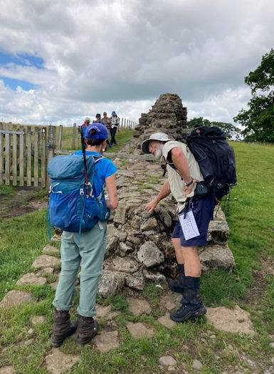
Discussion on the wall construction
| |
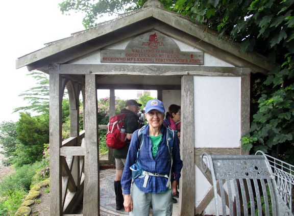
Judy at the start of the trek
| The first day we were taken to Bowness on Solway, from where walked to the official start, a small open shelter looking out to sea, marked with the mileage to Wallsend. After the essential group photos, we went through the villages alongside the estuary where many houses and walls had been built with blocks of sandstone from Hadrian’s Wall. Several of them had Roman altar stones built into part of a wall or garden. The walking here was easy, on paths and roads by the coast, and many swallows were swooping around. We met a number of other people going in both directions and congratulated those who were almost at the end. At this point it felt somewhat like a pilgrimage, with everyone knowing where each other were going.
| |
We passed Port Carlisle, the abandoned remains of a port built in 1819, with an 11 mile canal link to the city a few years later. It may have been intended to rival Liverpool as a major port, but appears not to have succeeded and was closed about 30 years later. The remaining walls of the port can be seen on a small island close to the village. After a small rain shower and a lunch stop at the church in Burgh by Sands, we walked the rest of the way back to our hotel in Carlisle for a second night.
In the morning we were able to make a slightly earlier start from the hotel to the Hadrian’s Wall path and Eastwards. This day’s route ran mainly through farmland, with skylarks overhead, but with almost no Wall to be seen. The weather forecast had indicated rain but we had only one very brief shower and much warm sunshine, so I was glad to be wearing shorts. We reached our destination of Lanercost Priory with plenty of time to explore around the Augustinian priory and its 13th century church, as well as taking advantage of its tea room. Some real rain came just as the coach came to pick us up, which was acceptable. We then stayed for two nights at a very good pub called Twice Brewed, which was just off the main ridge of hills along which the Wall runs, and provided convenient access for the following days.
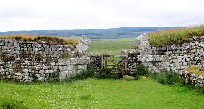
The next two days were the most spectacular for seeing the Wall, and also the hilliest and most interesting walking. It was a slightly late start, having had to wait for the transport back to Lanercost Priory, then a morning break rather sooner than necessary. However, the advantage was that the overnight rain had cleared, leaving us with a clear and sometimes sunny day. After a short stretch along a river we began to see elements of the Wall itself, including some well-preserved mile-castles, signal towers and turrets. The mile-castles are numbered from East to West, so we were able to count them down to note our progress along the route.
We stopped to look at the one at Hare Hill (no. 53) and again to view Birdoswald Fort, which was fairly incomplete but covered a large area. We spoke to a team of archaeologists there who were very excited about the new finds they were discovering every day. These had caused them to keep revising their views about the function of a particular section of the fort, which led to new ideas about who its inhabitants might had been.
Our lunch stop was in an interesting mile-castle which had many walls still standing. It was a privilege to sit where the Romans and their associates had worked and lived for hundreds of years. Surprisingly we met fewer people on this stretch of the route than at the beginning where there had been much less to see. Most of the people we did encounter here were visiting just to look at parts of the wall, rather than walking the route. In the afternoon we made a detour to Thirlwall Castle, a much younger relic, originally from the 12th century and rebuilt in the 14th.
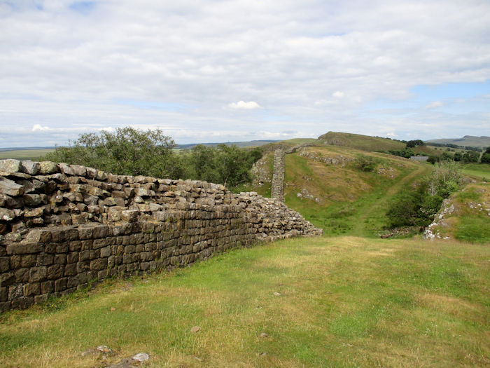
After all this sightseeing we still had a long way to go, over the hills of Cawfield Crags, Caw Gap and Winshields. Many of the group were flagging and needed plenty of rest stops, which meant we had to the chance to admire the views across to the Lake District and also the Pennines. The first of us reached the Twice Brewed pub before 7 pm but others were considerably later. Luckily we had not needed a transport pick-up that day and the pub staff were able to delay dinner for us.
It had rained in the night and continued for a few hours in the morning, though not heavily. Waterproofs were needed, but with minimal clothing underneath, as it was still warm.
Steel Rigg
| 
Approaching the Sycamore Gap
| |
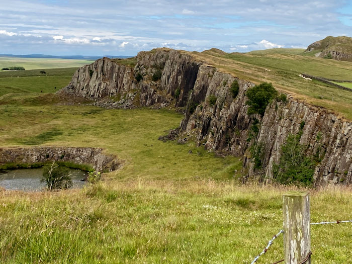
We walked up the road from the pub to Steel Rigg, the next section of the ridge, and above some climbing crags. A few breaks in the rain enabled us to see some good views of lakes and hills and to view some good turrets.
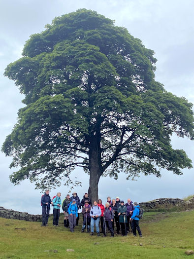
Group with the tree at the Gap
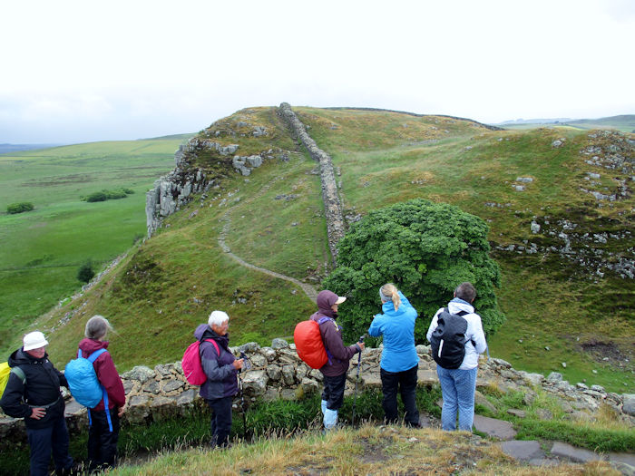
| We stopped at a place called Sycamore Gap, where there is a Sycamore tree, famous for appearing in a film of Robin Hood, and posed for compulsory group photos. Other breaks allowed a snack stop at a very nice fortlet with good views across the valley and masses of purple foxgloves. Much of this section was shared with the Pennine Way path. By lunchtime, just as we were all getting somewhat slightly fed up with walking in the rain, we came to a large barn just off the path, where a few other walkers had stopped to shelter. There was room for all of us to sit and eat lunch (a serendipitous find!), after which the rain stopped and the day became considerably brighter and warmer.
| |
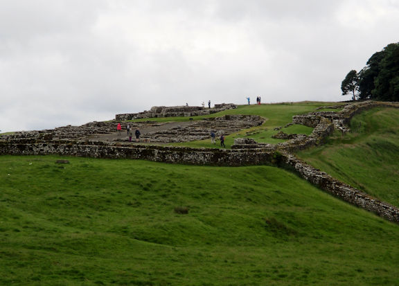
Later we passed more well-preserved features, including Housesteads Fort, and visited the very nice Roman temple to the god Mithras, with its three altars. We reached our destination in good time, so had another tea-room stop at Chesters Fort in Chollerford, from where we were taken to the next, very comfortable, hotel in Hexham.
Housesteads Fort
| 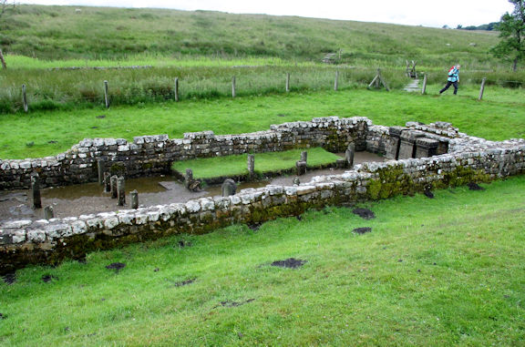
Temple of Mithras
| |
In the morning we took a lift back to Chollerford and had a pleasant day’s walk to Heddon-on-the-Wall, though with less Roman interest. At an early stage we visited a church at Heavenfield, dedicated to St Oswald, on the site of a battle to establish Celtic Christianity in the 7th Century. The path went over a few hills, sometimes alongside a road but separated from it by ditches and mounds. Some people slowed down in the afternoon so a few of us attempted to push the pace a little, which meant we all just made it to Heddon in time to catch our lift back to Hexham.
The final day of walking was varied and interesting, taking us from a large section of the Wall, to the Tyne valley, alongside the river and into the city of Newcastle, past features of industrial history. The weather was warm and mainly sunny again, so shorts were still the most suitable garb. We stopped to view a section of wall where the width had changed as it was built. The earliest section close to Newcastle was wider, about 9-10 feet, then further west it was only about 7-8 feet. After a viewpoint over the valley, we descended to follow the river and through parkland near Blaydon, where a noticeboard detailed some verses of the song ‘Blaydon Races’.
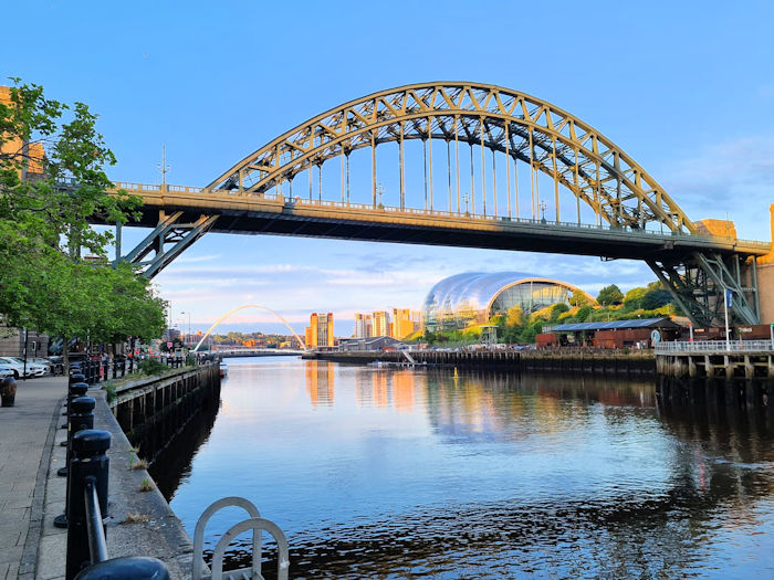
Tyne Bridges
| Soon we were in the city of Newcastle upon Tyne, walking along the river past all of its bridges. We stopped at the viewpoint from where it is possible to see all seven of them at once. For interest we crossed to the south side via William Armstrong’s historic swing bridge and back over the new Millennium Bridge which lifts to allow larger ships to pass underneath. Although our hotel was here on the riverfront, we continued past industrial areas to Wallsend where the Hadrian’s Wall path officially finishes at Segedunum Fort and museum. After a quick visit to the museum, with its tower viewpoint over the fort, we took a lift back to our hotel for a final dinner and farewells. The group had been great to travel with and for many of us this week had involved the most socialising we had done for 18 months.
| 
Near the end
| |
The following week Don and I were able to make the most of being in the North East, as he came up to Alnwick where we stayed in a very nice self-catering flat, converted from a farm building.
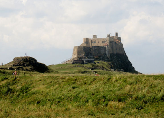
Lindesfarne Castle
| 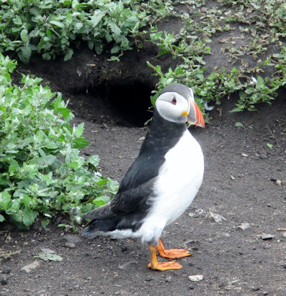
Farne Island puffin
| |
From there we visited many places of interest including the Farne inlands, Lindisfarne, Cragside House and the Northumberland coast, as well as catching up with some friends in Bamburgh.
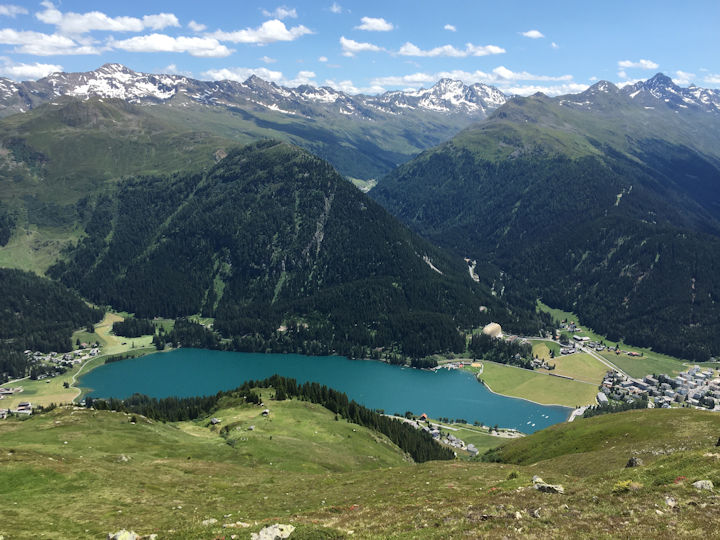
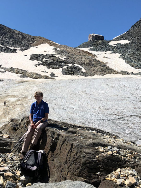
Summer in the Swiss Alps - Report by Pamela Harris For most of this year Covid restrictions continued to make foreign travel difficult, with the result that the club’s proposed Alpine hotel meet in the Val d’Anniviers had to be cancelled for a second time. So once again Alan and I set off on a meet for two, this time back to Klosters in the Graubunden, where we had spent ten glorious days on the 110th anniversary meet in 2019.
It was going to be very different from being with a large group of 42, so we decided to rent a self-catering apartment rather than stay in the Piz Buin Hotel again. It was in an equally good location, near the river and just a short walk to the train station and lifts. But most importantly, it gave us lots of space and the choice of eating in or exploring different restaurants for our evening meals.
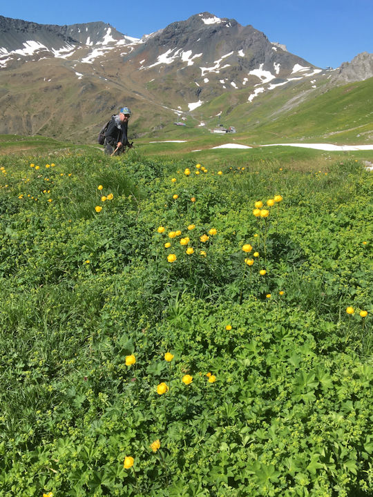
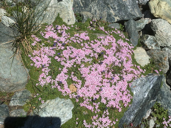
It was the beginning of July, and we were hoping for better weather than western Switzerland had experienced in the past months. We left home in lashing rain, wondering if we were doing the right thing, but amazingly we arrived in Klosters in brilliant sunshine, in time for a walk along the Landquart River towards Monbiel. We were not so lucky the next day, however, as we woke to find cloud almost down to the village, where it persistently remained for the next two days. At least it was not raining, and we found a network of paths around Klosters waiting to be explored, all below the cloud level. One led up towards Schlappin, through fields where hay was still stacked on wooden drying racks in the old-fashioned way and the meadows were a riot of pink, blue and yellow flowers. The next day we made the short train journey to nearby Davos and walked round the Davosersee, dodging the showers by taking refuge in a conveniently placed lakeside café. Despite the weather there were still people windsurfing on the lake, and at the side of the path were spotted orchids nestling in the high grass. Further along the lake where the trees grew closer to the path, we came across a family of black squirrels running up and down the trunks, so tame that they were taking food from the hands of the walkers in front of us.
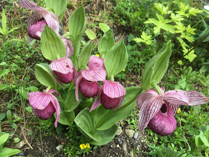
We had intended to walk from the lake along a high path back to Klosters, but when the showers became heavier, we put that off until the following day. We started by train again, and then walked up through the woods to the small lake of Schwarzsee near Laret, where we ate our picnic lunch. Once again spotted orchids grew everywhere, and as we reached Cavadurli, we could see how the train tracks looped round to lose height in the descent to Klosters. This was a walk that we had intended to do two years ago, but we had so much good weather then that we were able to go high every day. Fortunately the clouds lifted on the following day, and the sun was shining brightly as we set off on the “Panoramaweg” from the Gotschnagrat cable car high above Klosters. The path is aptly named for it provides a wonderful panorama as it contours along at 2300 metres, with spectacular views down onto the lake at Davos and across to the Silvretta peaks in Austria. Although we had seen lots of meadow flowers on our previous walks, I had been looking forward to seeing true alpines, and here we found them in multitudes. For the length of the trail the grassy slopes were covered with bright blue spring and trumpet gentians, pink alpenrose, yellow globeflowers, tiny lilac-coloured soldanellas, black vanilla orchids, bright pink primulas and a rare ground covering daphne, Daphne striata. After about an hour we passed the Parsenn hut and continued towards the middle station of the funicular coming up from Davos. This time we took it up to the top at Weissflühjoch, a barren wilderness with a café full of mountain bikers about to hurtle down the steep path to Davos. We did not join them, preferring the easier descent by the small train. The following day we returned to Davos to take the funicular to Schatzalp. We first walked through the Alpine Garden, up a steep slope past terraces of flowers. Most were alpines we had already seen on our walks, but there was a special section of Himalayan plants where we found the dark purple Tibetan slipper orchid (Cypripedium tibeticum), blue poppies (Meconopsis) and bright yellow Himalayan primulas. A gate led out through the top of the garden onto a path heading southwards on a long traverse through fir trees and meadows of grazing cows to reach a welcome café at Erbalp - which served delicious apfelstrudel - from where we descended more steeply to the streets of Davos once again. Our final day again dawned bright and sunny, and this time we took the Madrisa lift from Klosters Dorf. We set off on a gently undulating path eastwards towards Schlappinerjoch on the Austrian border, the slopes at the side of the path once again covered with alpenrose, trumpet gentians and tiny white orchids. But as the day wore on, the sun became hotter and the path steeper. We were becoming increasingly tired, and in the end turned back before the border in time to enjoy a drink on the sunny terrace before taking the last lift down.
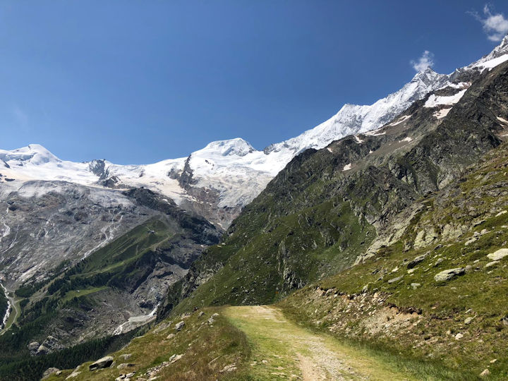
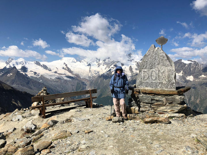
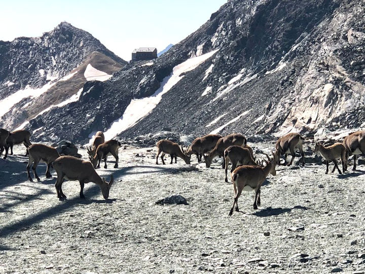
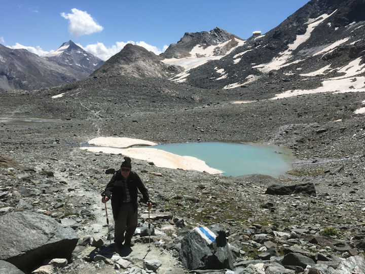
After a spring of walking in our local Jura mountains it had been good to get back to the Alps, and we were looking forward to our next trip, this time to the Saastal. But the rain set in again, and we had to wait until August for a period of good weather. Alan had never been to the Britannia Hut, and as far as I knew no one from the club had visited since August 2014 when I had accompanied Mike Pinney’s sister Margaret in her pilgrimage to donate Mike’s ice-axe. Back in 1912 the ABMSAC financed the building of the Hut, and thus it has always been important to the club and the focus of celebrations. The obvious place to stay was the Monte Moro Hotel in Saas-Almagell, which the club has made its base since the Centenary Meet in 2009. Annette was delighted to see us, and once again the hotel accommodation included the bonus of free rides on all lifts and buses in the valley.
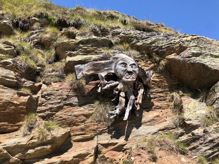
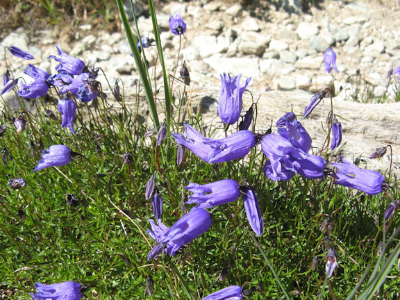
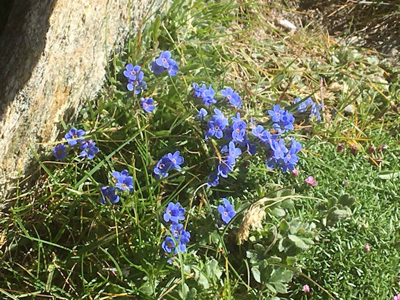
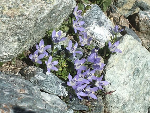
It was an easy drive from home, and by lunchtime we had caught the bus to Saas-Fee and lift to Hannig ready to start our first walk. It was a gloriously sunny day as we set out on a contouring trail high above the village, signposted by the wooden carving of a monster in the traditional Valaisian style. It was difficult to choose whether to look in front or below, for before us was a panorama of snow-covered peaks and at our feet a myriad of alpine flowers. The trail crossed streams and waterfalls, and at the Triftbach stream we passed the turn-off to the Mischabel Hut on the rocky slopes high above. We finally reached the other side of the valley at Gletschersee, the Glacier Lake, a wide expanse of milk-coloured water, from where we descended through larch woods to reach grassy meadows above the village. Here cows grazed peacefully, and the marmots had been fed by so many tourists that they were almost tame. On the following day we caught the cable car from Saas-Grund up to Hohsaas, a thousand metres below the towering snows of the Weissmiess, which several of our members had climbed in 2009. The view from here is one of the best in the valley for eighteen of the surrounding 4000 metre peaks can be seen rising above Saas-Fee. A panorama trail led across the snowy rocks, past cairns with information boards naming each peak, the date it was first climbed, and by whom. Most first ascents were made in the “Golden Age” of mountaineering, mainly by Victorian alpinists from Britain accompanied by Swiss guides. Some, such as the Allalinhorn, Strahlhorn, Alphubel and Rimpfischhorn, have been climbed by club members, although fewer have climbed the Dom, the highest peak of the Mischabel range. From Hohsaas we took the cable car down to Kreuzboden for what has become one of my favourite walks in the Valais, the “Blumenweg” or Flower walk. From the lift an undulating trail led southwards across grassy slopes, giving spectacular views across to the peaks we had seen from above. At our feet were numerous alpine flowers with small identification plaques naming each, and although we were too late for the trumpet gentians, we found alpenrose still in flower and a few rare edelweiss hiding in the long grass. It was a colourful walk, with bright pink dianthus, lilac-coloured field gentians, black vanilla orchids and bright blue perforated bellflowers, Campanula excisa, which I have only seen growing in this valley. But the most exciting find for me was the rare King of the Alps, Eritrichium nanum, its tiny bright blue flowers clinging to the rocks. After a short section through boulders and across an avalanche slope, where the path was protected by cables, we turned downhill to rejoin the cable car at Trift, the midway station. We now felt that we were acclimatised enough to attempt the Britannia Hut, and the next day took the Alpine Express from Saas-Fee up to Felskinn, just under 3000m. This was a world of snow and ice, and the path across to the Egginerjoch was busy, with several families on a day trip as well as better equipped alpinists. There was a herd of chamois at the Egginerjoch, and we had our first sight of the Hut on the ridge above. It looked all too easy, but unfortunately the shorter winter path across the Chessjen Glacier was closed for the summer, meaning that we had to go down on a rocky path towards Plattjen, losing 200 metres in height, and then climb up again. It didn’t sound much, but the rocks were uneven and difficult to negotiate, and we were very slow. As we clambered carefully down, we were overtaken by Dario, the hut warden, who stopped for a brief chat. It looked a barren place, but hidden in the rocks were pale pink moss campions and tiny pale bellflowers which I have never seen before and later identified as Mont Cenis Bellflower, Campanula cenisia. At the lowest point were two small glacial lakes to be circumnavigated, and we started on the upward trail towards the large snow slope below the hut. However, we finally had to admit that we were going too slowly to get to the hut and catch the last lift down - which left at what we thought was the ridiculously early time of 15:45 - so, just 80 metres below the hut, we turned back. Hopefully there will be another time! We left two easier walks for our last days, the first leading from the top of the chairlift from Saas-Almagell into the wild, secluded Fürggtälli, an unspoilt valley leading to the Antrona Pass, a medieval trade route into Italy too far for us to even contemplate reaching. Once we left the top of the lift there were no restaurants to attract the crowds, and we met few other walkers. We followed the stream up through larch trees and meadows bright with flowers, with no real aim except to enjoy a more relaxing day in the mountains.
Our last day in the Saastal was a contrast for the historic “Kappellenweg”, the Path of the Chapels, is one of the most popular walks in the valley. Starting at the Saas-Grund campsite, well-known to club members, it climbs up to Saas-Fee past fourteen small wayside shrines, each depicting a different episode in the life of Christ and his mother Mary, ending in an elaborately decorated chapel to Mary, scene of an annual pilgrimage in September. The shrines were built in 1709 and in total contain over a hundred wooden carved and painted figures. From Saas-Fee we took a gently descending path down to Saas-Almagell, past the attractive restaurant at Bodmen where we enjoyed a typical Valaisian lunch of rösti mit spiegelei on a sunny terrace.
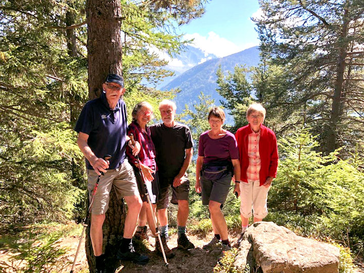
During the summer other ABMSAC members were able to join us, the first to arrive being Bill and Rosie Westermeyer from the US, who had not been able to visit Europe since the start of the pandemic. They made the most of being back in the Alps, with day trips to mountains nearer to their home at Divonne and a longer visit to Zermatt. At the end of the summer Geoff and Pauline Causey arrived from the Lake District to stay with Richard and Katherine Heery at Champex-Lac. Alan and I joined them one sunny day for a short walk above the lake, the Grand Combin appearing tantalisingly through the trees as Geoff and Richard picked out the ascent route they had taken in their youth. Let’s hope that next summer other UK members of the ABMSAC will once again be able to join us in the Swiss Alps, and perhaps a group of us will be able to walk up to “our” Britannia Hut once again.
Photos by Pamela Harris and Alan Norton Three day backpacking tour of the Lake District, July - Report by Paul Stock As part of our preparations for an Everest Base Camp trek due to take place in October 2021 (hopefully) Mitchell Sneddon and myself decided to take a tour of the Lake District. Originally it was planned to last for 5 days and take a much longer route, but due to unfavourable weather forecasts we adapted our route to suit the expected conditions.
Day 1 started from the George Starkey Hut at around 0900. We set off up the road towards Grisedale and then on to the rather steep path ascending Black Crag.
After a brief stop we descended to Deepdale Hause and then to Grisedale Tarn for lunch. There were a few groups of folks enjoying a swim.
After lunch we passed through Grisedale Hause and traversed the lower slopes of Seat Sandal to Little Tongue Gill where we made our descent to Grasmere. After some well deserved refreshments in the Travellers Rest Inn we made our way into Grasmere for a look around the very busy shops.
Day 1 ended in our first overnight stop at Baysbrown Campsite in Chapel Stile. The MWIS forecast did not look favourable for day 2 and onwards so the route was modified to keep us at reasonably low level.
We followed the Cumbrian Way to both the New and Old Dungeon Ghyll Hotels in the hope of a coffee with no luck at all as the “pingdemic” had reduced their opening times a services offered. After passing through a field containing a rather threatening bull the Cumbria Way continued up Mickleden to the head of the valley where the path splits into two. We took the Stakes Pass option and headed over the pass to the Langstrath valley.
The weather had steadily improved all morning giving way to bright sunshine for the descent. Many people were taking advantage of the sunny conditions whilst swimming in the deep stream pool at Blackmoss Pot. We passed a few wild campers just before turning the corner to Stonethwaite Campsite.
That evening at around 11pm the heavens opened and it rained all night. This is the first time we had camped in some years and the rain had kept us awake most of the night. However, at around 7am it stopped which allowed us to get packed up in the dry.
After second breakfast we followed the road to Manesty and then split from the Cumbria Way to follow the path to Hause Gate and onwards to an extremely busy Cat Bells summit. Enroute we had two heavy showers requiring full waterproofs to be deployed but on arrival at the summit the sun shone and the fabulous views were there for all to see.
We followed the crowds of day trippers to Hawes End to catch the ferry to Keswick. As luck would have it we arrived just in time for its departure and after a very short ferry trip we made our way to the nearest café for a late lunch.
The MWIS forecast again threatened further heavy rain with risk of thunder and lightening which forced a reluctant end to our tour of the Lake District and we retreated to the comfort of our homes on the South Coast.
The trip had been a success on many fronts. Much of our newly acquired camping kit worked extremely well and we had regained a healthy respect for those who carry heavier packs on the hills! It was the year the unthinkable happened, something so far reaching, it took us from the hills. Unimaginable, unprecedented, save for war time and the mercifully rare outbreaks of foot and mouth disease.
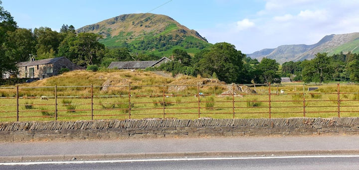
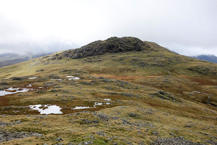
2020 was a time to read and reflect on peaks unclimbed, undiscovered routes and challenging fells hidden in plain sight. So it was with Glaramara, a brooding presence looking down on Seathwaite Farm where thousands arrive every year to head up the Scafell range.
Yet here, waymarked from the middle of the farmyard, lie miles of unpopulated hillwalking described as ‘difficult’ due to the lack of paths in the boggy, chaotic, terrain of the upper ground.
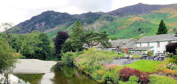
The idea came from ‘Chasing Snowflakes’, an interesting book recounting the life of Norman Worrall, known to the world as ‘Plum’. A founding member of the Karabiner Mountaineering Club in Manchester, Plum and his contemporaries were pioneers of mountaineering in all its forms and, in particular, the development of skiing in Scotland. In his later life, annual reunions were arranged, one of which, in 1989, gathered at the Royal Oak Hotel in Rosthwaite to climb up Combe Gill and take ‘the circular, high ridge walk around the mountain Glaramara.’
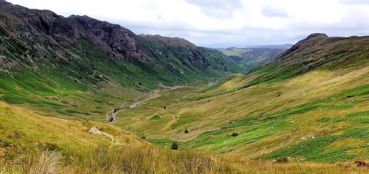
It is an exhilarating 8 hour day in the forgotten reaches of Thorneythwaite Fell, Combe Head, Glaramara and Bessyboot. This lesser trodden area offers commanding views of Dale Head, Fleetwith Pike and Green Gable, to Great Gable beyond, and the Scafell massif, plus the entire sweep of Borrowdale from The Combe, with Skiddaw in the distance.
There are two ways to gain height: a long traverse by Combe Gill to Thorneythwaite Fell or straight up the steep nose from Seathwaite. Whichever approach, the tracks at the top soon peter out into bogs and chossy outcrops, not a walk for poor weather as the going is rough and strenuous in places.
A rewarding detour to Combe Head offers fine views of the Langdale Pikes and Glaramara beckons with a 30’ scramble to the summit.
The options from here are to continue straight on to Allen Crags and down to Stockley Bridge from Esk Hause; to retrace your steps back to Seathwaite down the ‘impressive rift’ of Hind Gill; or to follow the high level return to Strands Bridge at Seatoller along Dovenest Top and Rosthwaite Cam.
On the day, the number of other walkers around The Combe hardly broke double figures while the procession of tiny figures visible on the distant Corridor Route told a different story.
After months yearning to be outdoors again, the tranquil fells of Glaramara could hardly be bettered.
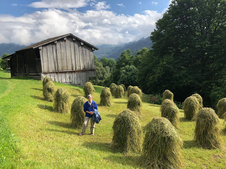
Hayfields above Klosters
Davos Lake from the Panoramaweg
Walking through flowers on the Panoramaweg
Tibetan slipper orchids
Monster signpost
Walking from Hannig
Mischabel range from Hohsaas
 Perforated bellflower
 King of the Alps
Britannia Hut from the Egginerjoch
 Moss campion
 Mont Cenis Bellflower
Glacial Lakes below the Hut
Britannia Hut from the Egginerjoch
Group at Champex-Lac
View of Black Crag and St Sunday Crag from the hut
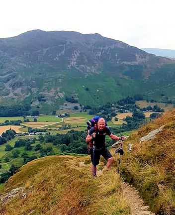 Mitchell Sneddon on the path to Black Crag
The weather was a warm 20 degrees Celsius with blue skies with occasional clouds and no wind. Carrying a rather heavy 16kg rucksack we arrived at the summit of St Sunday Crag in 2 hours 40 mins.
There were great views of all the surrounding peaks without the accompanying crowds that some of them attract during peak holiday periods.
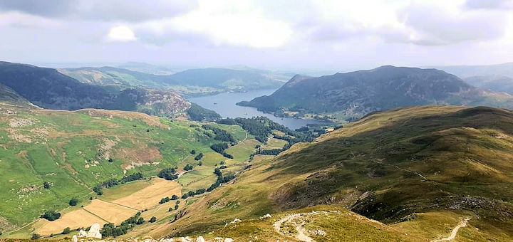 Ullswater from the final slopes of St Sunday
 Paul Stock with Grisedale tarn in the background
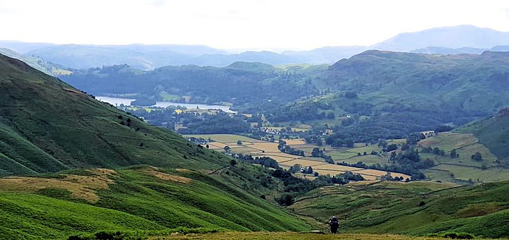 Grasmere from the Great Tongue
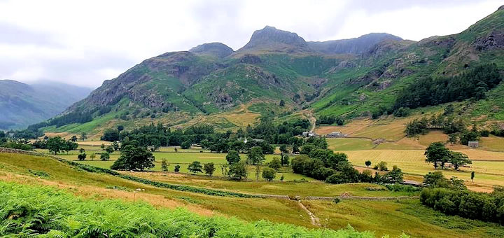 Great Langdale from the Cumbria Way path
 Mickleden Valley from the Cumbria Way
 Paul at Stakes Pass
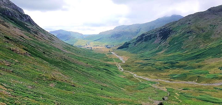
 Langstrath valley from Stakes Pass
 Approaching Grange
Day 3 started from the campsite and we headed to Longthwaite where we followed the Cumbria Way along the River Derwent to Grange.
At last we found a coffee shop open for a quick refreshment and breakfast roll.
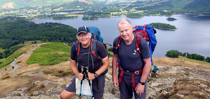
Paul and Mitch on Cat Bells Summit
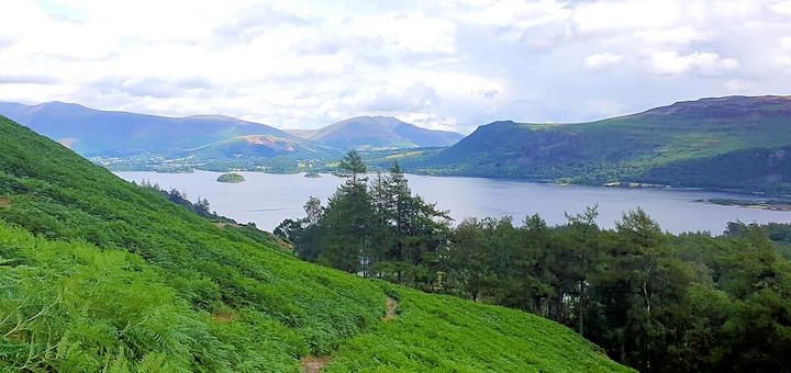
Derwent Water from the Hause Gate approach path
A day out in the Lakes - Seatoller, Glaramara, Rosthwaite - Report by: Beth & Julie Jones – 1 July, 2021
Glaramara approach
Glaramara summit
Combe Head
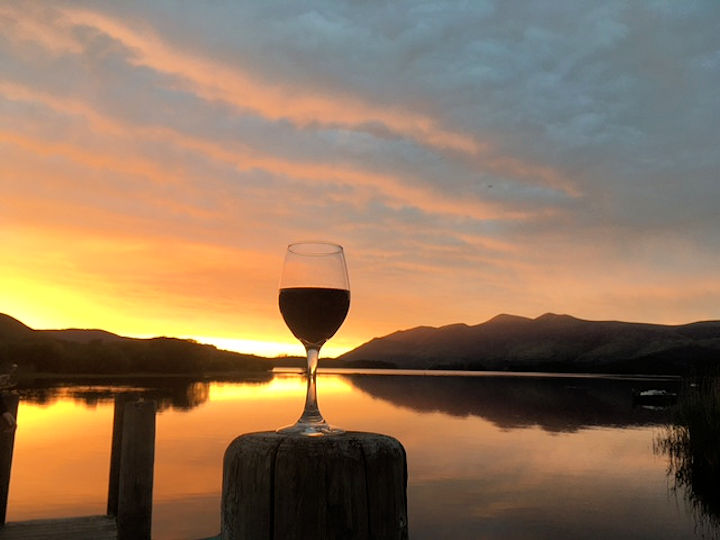
Derwentwater sunset
